You found all the bears and their friends last national lockdown, so this time see if you can find our lost gear scattered around New Zealand in the Gear Hunt! @bivouacoutdoor are running this one, so check out their twitter feed for the clues!
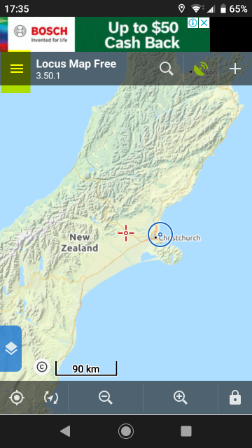
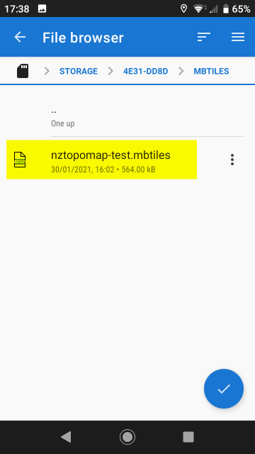
The popular Locus Map app for Android phones & tablets is able to load MBTiles tilesets for offline use. It can also load the MBTiles files from the SD card which is a useful feature when storage space is at a premium.
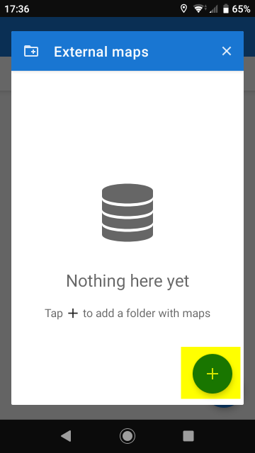
This is a quick step-by-step guide to loading MBTiles tilesets onto your Android device, as it may not be the most intuitive process for newer Locus Map users…
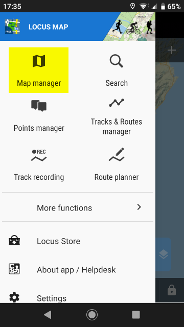
Open the top left menu:
Open the Map manager:
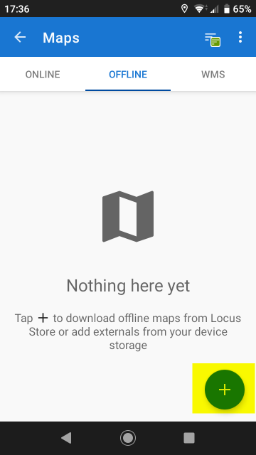
Add a new offline map:
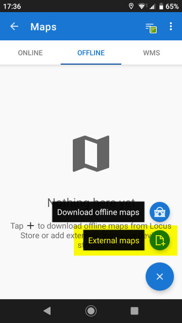
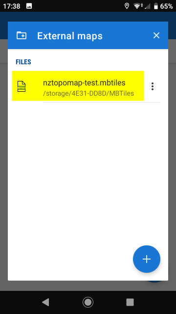
Choose External maps:
Use the add button:
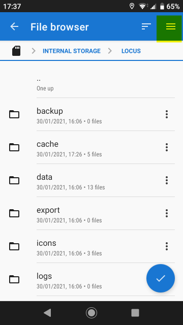
If your MBTiles file isn’t located on the devices internal storage, use the top right menu item:
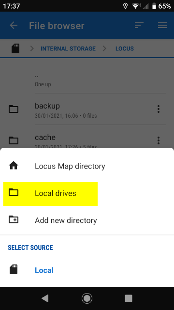
Select Local drives:
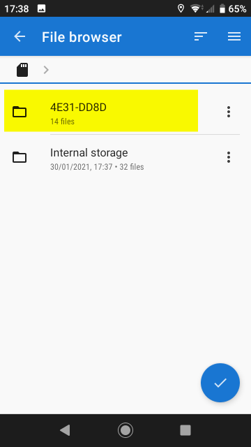
The SD card may not have an obvious name:
Locate your MBTiles files and select it:
Select the External map that has now been added:
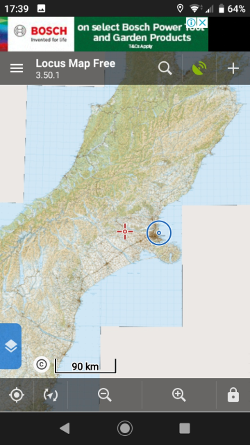
Enjoy the map:
The Bear Hunt is on!
Some light entertainment based on the popular lockdown Bear Hunt…
Some naughty teddy bears and their friends have snuck off into the wilds, can you help find them? You’ll be in to win some great prizes if you do!
You can easily print sections of topo map directly from NZ Topo Map using the provided print functionality but sometimes you want something a bit more professional…
Topo50 Map Sheets
The complete range of official LINZ printed map sheets are available from Bivouac.
If you’re willing to spend a bit extra for something a bit more durable then Repro-Online can provide the maps printed on Tyvek -
“They are completely waterproof, resist mildew and mold, not affected by petrol, diesel or other solvents, can be rolled and folded unlike plain paper laminated charts which they replace. They can be written on, almost impossible to tear and extremely durable.”
Both LINZ Maritme Charts and Topo50 Maps are available from
Repro-Online.
If you want to print the Topo50 maps yourself, then they are available as downloads from the Tools > Downloads menu on NZ Topo Map.
Great Walk Maps
Geographx provides maps for each of the nine New Zealand Great Walks -
“These maps are double-sided and available folded or flat (rolled). Each has a 2D plan map of the featured track on one side and a 3D map of the wider region on the reverse (the exception is the Whanganui River map, where different sections of the river are featured on each side). The maps are sized 840 x 594 mm. They are printed on waterproof, tear-resistant, environmentally sustainable Stone Paper.”
Custom Maps
If your map printing requirements are a bit more specialised then give SB Consulting a shout, they help you out -
E: steven@sbconsulting.co.nz P: 027 4498 404
Entertainment Book
Show your support for NZ Topo Map by buying an Entertainment Book / App. It’s a win-win - 20% of every membership sold contributes towards hosting, developing, improving and maintaining the service and you get great deals.
What’s to lose? Go out for a meal twice using the Entertainment Book and you’ve most likely already recovered the cost of the book. Treat yourself.
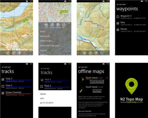
The app has lots of useful features, but probably the most valuable is the ability to take the NZ topos offline with you when you go bush. Sections of map can be downloaded individually, or you can download the entire North or South Island so you always have the complete topo map available on-hand whenever you want.
Top tip: Turn flight mode on when you’re in the bush without a cell signal, you’re battery will last a lot longer! You can still use GPS for tracking while flight mode is on.
Got some spare ad space?
Would like to show your support for NZ Topo Map and have some spare ad space? Feel free to flick the service an ad and use any of the ad images below. Thank you!
Leaderboard (728 x 90)
Full Banner (468 x 60)
Small Square (200 x 200)
Square (250 x 250)
Medium Rectangle (300 x 250)
Large Rectangle (336 x 280)
Wide Skyscraper (160 x 600)
Skyscraper (120 x 600)
Winners of the Christmas Pressie Hunt
The prize draw has now been made and the winners contacted. It’s now my pleasure to announce the winners of the Christmas Pressie Hunt on NZ Topo Map…
Shane Hunt from Auckland won the $250 Bivouac Outdoor Shopping Spree
Nicky Armstrong from Westport, Leigh Quadling-Miernik from Auckland, Michelle Conder also from Auckland all won Osprey Raptor 6 Packs
Pearce Carey from Benneydale, Josh Sullivan from Dunedin, Dan Roberts from Auckland all won Camelbak Hydration Packs
Tim Wiel from Waihola, Bill Krippner from Auckland, Dave McFadzien from Gore, Andrew Scott from Christchurch, Clare Macintosh from Auckland, all won Wilderness Magazine subscriptions
Congratulations to all the winners! And thanks to everyone who expressed their enjoyment taking part in the Christmas Pressie Hunt, as well as the generous sponsors who provided all the great prizes and made it all possible!
The sponsors have now been informed of the winners and will be sending the prizes directly.
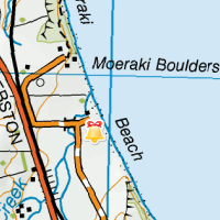
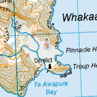
Maori legend tells that the boulders are remains of calabashes, kumaras and eel baskets that washed ashore after the legendary canoe, the Araiteuru was wrecked at nearby Shag Point (Matakaea).